Augmented reality in the AEC industry
Who has heard of Augmented Reality? I’m guessing almost everyone has seen it in one form or another. Augmented Reality (AR) is simply the digital manipulation of the real world. It can be seen while playing with your kid’s Nintendo 3DS, using retailer apps on your phone (my wife loves Ikea’s) or just watching a football game.
During a televised football game, the first down marker superimposed on a football field is a great example of AR. We all know the marker is only there digitally but it moves with the physical first down markers and its perceived location adjusts with the camera as it moves, all in real time. The same can be done with the 3D content we now produce on a daily basis.
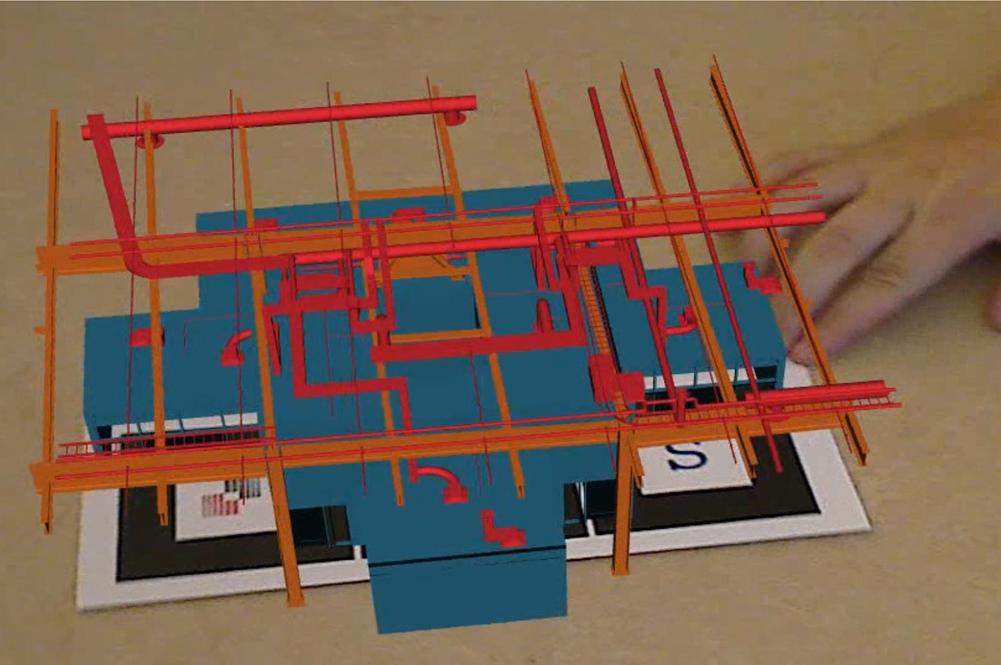
For AEC industry purposes there are essentially two forms of Augmented Reality – marker based and GPS based. CEM AR Video ImageMarker based AR uses a simple image like a business card to anchor your model and give it origin, scale and orientation.
GPS based AR gives your model a real world physical location that can then be visualized using a smart phone, tablet or laptop in the field.
The video below shows a small residential building with three separate markers representing architectural, mechanical and structural elements. Using a computer, a program called AR-media and a web camera I was able to superimpose a 3D model of the building over the markers. As the markers are unblocked the building elements appear. As I rotate the markers the model moves in real time to match the markers.
Using GPS based Augmented Reality, a 3D model is exported for use in a mobile device, like a tablet or smart phone. GPS coordinates of the project are assigned to the model, so that when on site, a phone or tablet can act as a looking glass. By using your tablet or phone, you can pan across the site and the proposed building appears as if already built. As the user moves closer or walks around the site the 3D model’s scale and orientation adjusts in real time to maintain the illusion.
So how can we use AR in our industry? During coordination meetings AR can be used to visualize discipline interactions using multiple markers, like shown in the video above. Design concepts can be quickly evaluated and manipulated using a web camera and AR markers to manipulate the model. Site planning can be coordinated between multiple buildings and existing site conditions as if work was completed using GPS based AR. And finally (and maybe most importantly), it can be used to help owners visualize their building in its planned space.
*Credit: Chris Morgan, LEED AP
Chris is a Technical Associate at PAE and a mechanical designer with fifteen years of experience focused on innovative design tools, from implementation and workflow to design and coordination. *


